 Darren Wiens
DEM to Horizon Workflow
Mon 15 May 2023I spent last week surrounded by the massive mountains in beautiful Banff, AB. Rather than just enjoy myself, I started concocting a geospatial side project, the first step of which involves generating horizon profiles on demand. So, the question here is: can I generate a horizon profile panorama only given a digital elevation model (DEM) and point coordinates for any observer location? I'm happy to report that the answer is: yes.
The steps to get there are:
- download a DEM from somewhere. I used a DEM from the Canadian Digital Elevation Model dataset, but you could use anything for your desired area.
- if the DEM is defined in a geographic coordinate reference system, project it. I used QGIS to reproject my DEM.
-
follow along in my notebook here, which demonstrates how to:
- define the observer position
- create viewshed, distance, angle, and perspective layers
- create a horizon profile panorama using the layers creating above
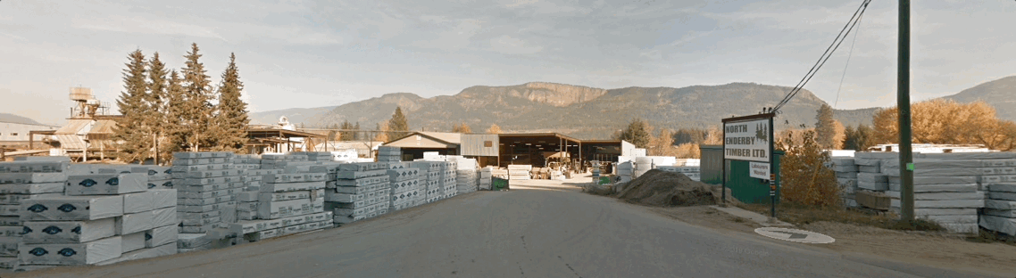
The result should be a scatter plot showing a horion profile panorama, which you can overlay over your own oblique imagery or, for example, Google Street View imagery.
That's it! Enjoy using the DEM to horizon workflow. If you have any questions, reach out to me on Twitter or Mastodon.